

Death Valley
Inyo County · California · United States
Death Valley offers active travelers hiking terrain and renowned night skies, perfect for outdoor movement enthusiasts.
Death Valley offers active travelers hiking terrain and renowned night skies, perfect for outdoor movement enthusiasts.
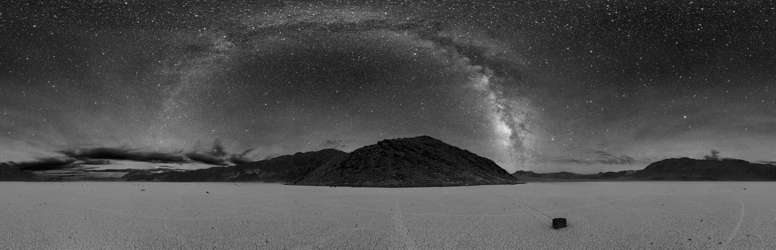
Dan Duriscoe, for the en:U.S. National Park Service . · Wikimedia Commons · Public domain · Dan Duriscoe, for the en:U.S. National Park Service . — Public domain; via Wikimedia Commons. Resized and supplied with verified synthetic GPS metadata.

Sted, kort og geografiske oplysninger identificeret i denne scanning.
Gem stedet, tilføj datoer, og sammenlign faktiske ruter i Wayonara.
Death Valley’s desert landscape provides active travelers with distinctive hiking opportunities, such as the trails around Racetrack Playa. The area’s geological features, including sailing stones, offer both a physical challenge and a unique natural spectacle. Visitors inclined to active weekends will find its quiet environment conducive to immersive outdoor activity. At night, Death Valley’s dark skies reveal the Milky Way in vivid detail, making it an exceptional setting for those who combine hiking with night photography or stargazing. This blend of terrain and celestial clarity underlines Death Valley’s value to those planning trips centered on hiking and natural observations.
Del din placering én gang, eller angiv en afrejseby. Din position afrundes og offentliggøres aldrig.
Priserne, der vises her, er enten tjekket for nylig eller tydeligt markeret som vejledende.
Kun scanningsstedet er tilgængeligt. En fuld rejseplan kræver flere bekræftede stop.
Foreslået besøg
Årlig rytme
Klimarytme
Månedlige maksimum- og minimumstemperaturer vises ovenfor; nedbørsmængder vises nedenfor, så du hurtigt kan danne dig et indtryk af sæsonen.Kilde: Open-Meteo
En kompakt pakkeliste baseret på forholdene på destinationen.
USD ($)
English
America/New_York
Type A/B
120V · 60Hz
Offentlige delingslinks viser kun detaljer om den offentlige scanning. Private scanninger, udgangspunkt, budget, gemte rejsedata og kontooplysninger vises ikke her. Hvis ejeren sletter scanningen eller gør den privat, vil denne side ikke længere fungere.