

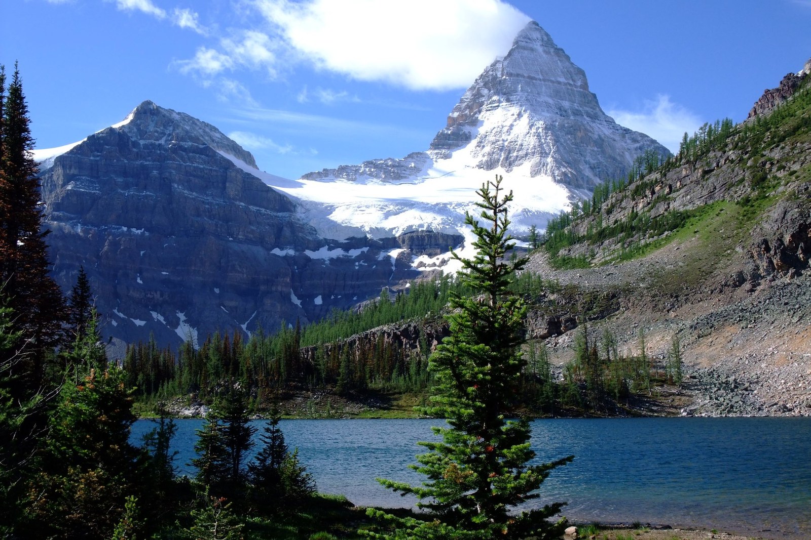
Mount Assiniboine
East Kootenay · British Columbia · Canada
Mount Assiniboine gives mountain travellers a stronger day when route, weather and turnaround margins are decided first.
Mount Assiniboine gives mountain travellers a stronger day when route, weather and turnaround margins are decided first.
Kurt Stegmüller · Wikimedia Commons · CC BY 3.0 · Kurt Stegmüller — CC BY 3.0; via Wikimedia Commons. Resized and supplied with verified synthetic GPS metadata.
Bu taramada tespit edilen mekan, harita ve coğrafi detaylar.
Yeri kaydedin, tarihleri ekleyin ve Wayonara üzerinde gerçek rotaları karşılaştırın.
Mount Assiniboine is a remote, sharply pyramidal peak in the Canadian Rockies of British Columbia, surrounded by alpine lakes, meadows and long backcountry approaches. There is no simple roadside summit visit: distance, isolation and limited services are part of the place’s character. Plan access and overnight logistics as carefully as the walking route, including how the group will respond if weather delays progress. Set a primary route, a shorter alternative and a firm turnaround point before starting. Compare distance, ascent and surface with the group’s real experience, not only the headline viewpoint. Begin with enough daylight, take measured breaks and keep the return route easy to identify even if cloud reduces visibility. Mountain travellers should treat Mount Assiniboine as an outing whose quality depends on preparation. Match distance and ascent to the least experienced person, keep turnaround time visible, and preserve energy for the return. A clear route plan creates more time to notice terrain, weather and scale without turning the day into a race. Backcountry rules, reservations and transport arrangements can change; confirm them with the responsible park services and carry bear-aware food storage appropriate to the itinerary.
Konumunuzu bir kez paylaşın veya bir kalkış şehri girin. Konumunuz genelleştirilir ve asla yayınlanmaz.
Burada gösterilen fiyatlar ya yakın zamanda kontrol edilmiştir ya da açıkça tahmini olarak belirtilmiştir.
Yalnızca tarama konumu mevcut. Tam güzergâh için daha fazla doğrulanmış durak gerekir.
Önerilen ziyaret
Yıl boyu süren döngü
İklim döngüsü
Aylık en yüksek ve en düşük sıcaklıklar yukarıda; hızlı bir mevsimsel inceleme için yağış miktarı aşağıda yer almaktadır.Kaynak: Open-Meteo
Destinasyon koşullarına göre hazırlanmış derli toplu bir başlangıç bavul listesi.
Use Mount Assiniboine as the destination context and choose verified regional food guides before deciding where or what to eat.
CAD ($)
English · French
America/St_Johns
Type A/B
120V · 60Hz
Herkese açık paylaşım bağlantıları yalnızca herkese açık tarama detaylarını gösterir. Gizli taramalar, kalkış noktası, bütçe, kaydedilen seyahat verileri ve hesap bilgileri burada gösterilmez. Sahibi bu taramayı siler veya gizli yaparsa, bu sayfa çalışmayı durdurur.